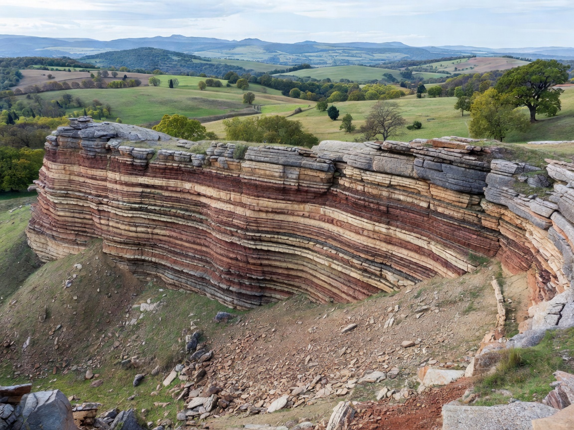
Fossils occur where organisms or traces were buried and preserved, then exposed or sampled. Europe contains many kinds of geological terrain, but a mapped formation is not a promise of a visible fossil, public access or permission to collect.
Why geology controls the record
Most familiar body fossils occur in sedimentary rocks. Sand, mud, carbonate and other particles accumulate in environments such as seas, river plains, deltas and lakes. Rapid burial can protect remains from scavenging and decay. Over time, sediment compacts and minerals may alter the original material. Igneous heat and intense metamorphism can destroy or distort many fossils, so fossil-bearing rocks are often sedimentary layers that escaped later alteration.
The record is incomplete. Conditions that preserve shells may not preserve soft-bodied organisms. Erosion can reveal a layer, bury it again or remove it. A fossil’s absence at a particular exposure does not establish that its broader formation is barren.
Coasts, quarries and natural outcrops
Coastal exposures can reveal long runs of layered rock, sometimes refreshed by erosion. They also change. Tides, unstable cliffs, falling debris and fast weather shifts make some coastlines hazardous. Observe from safe public areas and respect signs, closures and protected-site rules. Do not climb cliffs or enter restricted structures to reach a layer.
Quarries may expose rock that is otherwise difficult to see. Active and disused workings are not automatically open to visitors. Entry may be controlled by owners, operators or safety law. A public viewpoint, guided visit or museum display can provide a safer alternative. Natural inland outcrops and road cuttings also have access limits; roadsides are not safe stopping places unless a designated space exists.
Marine, terrestrial and freshwater evidence
Marine sediments may preserve shells, corals, fish remains and trace fossils—marks such as burrows or tracks. Their presence can indicate aspects of an ancient water environment, but interpretation depends on the full geological context. Terrestrial deposits can preserve plant remains, pollen, insects, bones and footprints. River and lake deposits may mix material transported from different places. Fossils can therefore be out of their original habitat or position.
Mountain regions add another layer of complexity. Sedimentary strata may have been folded, faulted, uplifted or metamorphosed. A fossil-bearing sequence can be difficult to access even when its geology is well documented. Caves may contain remains introduced by water, animals or human activity; cave deposits need specialist context and protection.
Regional differences are not a ranking
European geological regions represent different histories, not a simple scale of fossil quality. A coastal sedimentary basin, an uplifted mountain belt and a limestone cave system preserve different materials and are studied with different methods. The same fossil group may occur in several regions, while local geology controls its abundance, condition and exposure.
For a regional comparison, consult a national or regional geological map, formation descriptions and museum or survey material. Check the age, rock type and mapped boundaries. A formation name identifies a unit of rock; it does not guarantee a fossil locality or right of entry. Published maps may also use different scales and classifications.
Access and responsible observation
- Confirm land ownership, access routes and current restrictions before travel.
- Check whether an area is protected and whether collecting is prohibited or permit-controlled.
- Stay on designated paths and keep away from unstable slopes, cliffs and active workings.
- Photograph in place where lawful. Record broad context rather than disturbing an exposure.
- Do not assume that a site described in a guide remains open or safe.
Good for
Comparing geological environments, learning how sedimentary settings shape fossil records, and planning research with maps before choosing a destination.
What to know
Site access, collecting rules and conditions change. Geological suitability is not public access. Verify information with relevant land managers and local authorities.
Useful comparison checklist
For each region, note the dominant rock type, likely depositional setting, exposure style, known access conditions and available museum interpretation. Keep mapped geological information separate from current visitor guidance. That distinction prevents an educational map from being mistaken for a field-access permit.
Plan a responsible next step
Use the atlas to form a question, then consult authoritative local sources. A museum visit can add context before field observation. If a site is protected, private or operational, use permitted alternatives rather than seeking an informal route in.