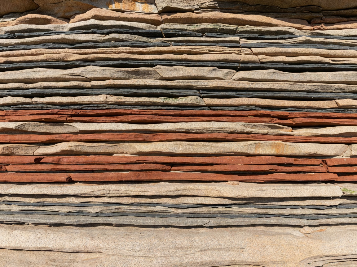
Geological time is divided into named units so researchers can describe and compare Earth history. Fossils help identify and interpret some rock layers, while the rocks themselves provide evidence about deposition, deformation and later change.
From Precambrian to Cenozoic
The Precambrian is the broad span of time before the start of the Cambrian Period. It includes the Archean and Proterozoic eons and represents most of Earth’s history. Fossil evidence from this immense interval is often microscopic or preserved in forms that require specialist interpretation. Preservation and the nature of early life limit what can be reconstructed.
The Paleozoic Era follows the Precambrian and includes periods such as the Cambrian, Ordovician, Silurian, Devonian, Carboniferous and Permian. It records major changes in marine life and the development of life on land. The Mesozoic Era comprises the Triassic, Jurassic and Cretaceous periods. The Cenozoic Era begins after the end-Cretaceous extinction and continues to the present, including the Paleogene, Neogene and Quaternary periods.
These divisions are established parts of the international geological time scale. Their boundaries are based on evidence and formal definitions, and numerical ages are refined as dating methods improve. For exact boundary ages, use the current International Commission on Stratigraphy chart rather than relying on an undated summary. Period names describe intervals; they do not identify the age of a fossil by themselves.
Stratigraphy: relationships between layers
Stratigraphy describes rock layers and their order, composition and relationships. In an undisturbed sequence, lower layers are generally older than the layers above them. This principle is called superposition. Folding, faulting, erosion and overturning can complicate the sequence, so geologists test the relationships rather than applying the rule blindly.
A stratigraphic section is a measured or described sequence of rock. It can record changes from mud to sand, marine to terrestrial deposits, or one depositional condition to another. A formation is a named rock unit mapped and described using consistent criteria. Formations may cross time boundaries or represent only part of an interval; they are not interchangeable with geological periods.
How sediments become fossil-bearing rock
Sediment is material deposited by processes such as water flow, wind, gravity or chemical precipitation. Burial can limit exposure to oxygen and scavengers, creating conditions that improve preservation. Compaction squeezes sediment; cementation binds grains together. These processes form sedimentary rock, but fossilization is not a single route and does not always preserve original tissues.
Minerals may replace or fill parts of remains. An impression can record an organism’s surface, while a cast forms when a cavity is filled with sediment or minerals. A trace fossil records activity—such as a burrow or track—rather than a body. In some settings, chemical conditions preserve fine details; in others, only a resistant structure remains. Fossil preservation reflects both the organism and its burial and geological history.
Reconstructing ancient environments
Researchers combine fossil assemblages, sediment structures, rock chemistry and the position of layers to infer past environments. A shell might support a marine interpretation, but it could have been transported. A single fossil is rarely enough to reconstruct an ecosystem. The surrounding sediment, other fossils and regional geology provide additional evidence.
Interpretations can change when new data, improved dating or revised taxonomy becomes available. Some deposits reflect mixed or rapidly changing conditions. Scientific descriptions should distinguish observation—what is present—from interpretation—what process or environment may explain it. When evidence allows more than one interpretation, uncertainty is part of the result rather than a flaw.
Extinction events and the fossil record
Extinction is the loss of a species or group. The fossil record documents changes in fossil occurrence, but gaps can arise from erosion, non-deposition, limited sampling or poor preservation. A change between layers may signal ecological turnover, a shift in environment or a gap in the record. Researchers compare multiple lines of evidence before drawing conclusions about cause or timing.
Large extinction events are recognized from broad patterns in the geological record. The detail and timing of local effects can vary. Avoid treating a single site as a complete record of a global event. Regional geology, dating resolution and preservation all affect what can be seen.
Read context before assigning an age
- Record the rock unit and source of its identification.
- Note whether a fossil was found in place or as loose material.
- Separate a broad period label from a formally dated age.
- Check whether the layer has been folded, faulted or reworked.
- Keep environmental interpretations proportional to the evidence.
Good for
Building a reliable framework for comparing fossils, reading museum labels and understanding how local layers relate to broader Earth history.
What to know
Rock units and time units are not the same. Ages and interpretations may be refined; cite the source and date of a time-scale reference.
A disciplined interpretation
Start with what is directly observable: layer position, rock texture, fossil form and associations. Then consult geological mapping, institutional records and current time-scale references. Describe uncertainty clearly. This sequence makes interpretations easier to review and less likely to overstate what one specimen can establish.